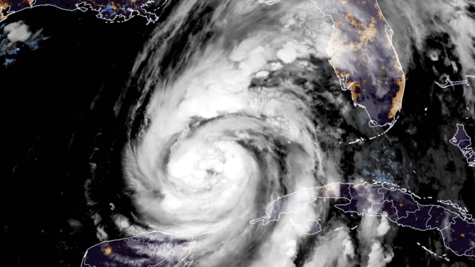
Hurricane Helene to hit southeastern US with catastrophic impacts

- Published
Southeastern states of the US are bracing for storm surges, flooding rains and strong winds as Hurricane Helene approaches.
Helene has intensified in the Gulf of Mexico and is expected to make landfall in Florida on Thursday as a category 4 major hurricane, with winds gusts up to 161mph (260 km/h).
Official forecasts and warnings describe the likely impacts as "catastrophic", "life threatening" and "unsurvivable", with mandatory and voluntary evacuation orders in place.
Parts of Georgia and South Carolina will also be threatened as Helene moves inland.
Helene is expected to make landfall in the Big Bend of Florida as a major category 4 hurricane on Thursday evening local time
What path will Helene take?
Helene will be the fourth hurricane to hit the contiguous US so far this year.
Hurricane watches and warnings are already in force along the entirety of the west coast of Florida from the Keys to the Panhandle.
Helene will reach maximum strength as a category 4 major hurricane just before making landfall on Thursday evening local time in the Big Bend counties of Taylor, Jefferson and Wakulla.
However, at around 600 miles (970km) wide, Helene will bring life-threatening impacts over a much larger area.
The entire west coast of Florida is under a storm surge warning with 3-5ft (1-1.5m) at least.
Tampa Bay could have a surge of 5-8ft (1.5-2.5m) but around the Big Bend - specifically Carrabelle to Suwannee River - there could be as much as 20ft (6m) of water inundating land.
Wind speeds are likely to strengthen early on Thursday morning before reaching hurricane-force strength with gusts up to 161mph (260 km/h) just before landfall.
As Helene will be moving fast onto land, gusts of wind over 100mph (160km/h) will still be felt well inland with the city of Tallahassee potentially seeing widespread damage.
The National Hurricane Center is warning that rainfall totals around north-west Florida could be as high as 12in (300mm) and are likely to cause considerable flash flooding.
Rain will not be limited to Florida, either, as Helene travels further inland.
Up to 12in (300mm) is predicted for parts of Georgia and South Carolina, but as much as 18in (460mm) in the Southern Appalachians.
Following on from last week's flooding rains, this increases the risk of flash floods and landslides as the ground is already saturated.
No more time to prepare
At a news conference on Thursday, Tallahassee mayor John E. Dailey warned residents to be prepared.
He said: "We have no more time left to wait. Today is the day. We urge you to stay weather aware as we’re on the verge of what could be…a historic event.”
Florida governor Ron DeSantis has declared a state of emergency for 61 of the state’s 69 counties.
The Florida National Guard has mobilised nearly 3,500 soldiers and airmen in preparation for the hurricane.
In Georgia, all public schools in Atlanta will close on Thursday and Friday due to the storm.
It has also affected the race for the White House, with Republican candidate for Vice President JD Vance cancelling two events in Georgia that were planned for Thursday.
Tropical Storm Helene will rapidly intensify as it travels northward in the record warm waters of the Gulf of Mexico
Helene will strengthen rapidly
Hurricanes need sea surface temperatures of more than 27C (80F) to fuel them.
With exceptionally warm waters of the Gulf at 30-32C (86-89F), the sea surface is around two degrees Celsius above normal for the time of year.
This will supercharge Helene's development and bring what meteorologists call "rapid intensification".
Analysis from University of Miami meteorologist Brian McNoldy shows that ocean heat content in the Gulf of Mexico is at record levels in 2024.
As a category 1 hurricane on Thursday morning with average wind speeds of 86mph (138 km/h) and with nothing but very warm waters to continue to fuel this storm, it will get stronger.
By landfall late on Thursday, it is expected to be a major category 4 hurricane with wind gusts of 161mph (260km/h).
Hurricane Helene will be a historic storm for southeastern states of the US and will be closely monitored.
- Published9 October