Protecting South Africa's neglected shrublands
A new project aims to create a system to predict why grassy shrublands are disappearing - is it deliberate human action or a seasonal, natural event?
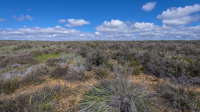
South African researchers have developed a new monitoring app to protect the most endangered ecosystem there. And no, it's not the forests, it's called the Renosterveld - an area of open grassland with a rich biodiversity but where only 5% remains after encroachment by farming.
Over the past two year the researchers have been examining thousands of high resolution satellite images to create a data-set which allows artificial intelligence to see week by week if new land has been ploughed up. And it's a system that could be used in other neglected ecosystems in different countries, according to Glenn Moncrieff from the South African Environmental Observation Network.
"We combed through a bunch of images to identify what the signal is in satellite imagery of these events in which Renosterveld is removed and converted to farmland. We were able to identify the fingerprint of what this looks like. This enables us to make predictions."
"In order to find what an unnatural change looks like you have to really get a lot of and try to find that signal (because) the conversion of this natural vegetation to bare soil has a somewhat different signal (compared) to the conversion to burnt vegetation or the seasonal variation (caused by Summer droughts). We hope to show how this can be done to allow others to apply the same techniques across the world."
(Pic: Renosterveld landscape, South Africa; Credit: Getty images)
Duration:
This clip is from
More clips from Newsday
-
![]()
Liam Payne: Fans mourn death of One Direction singer
Duration: 03:35
-
![]()
Sudan's footballers provide 'joy amongst the chaos'
Duration: 04:00
-
![]()
Hurricane Milton: The residents deciding to stay, or evacuate
Duration: 02:59


